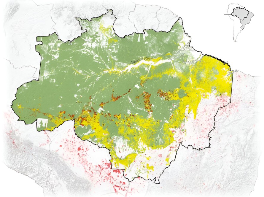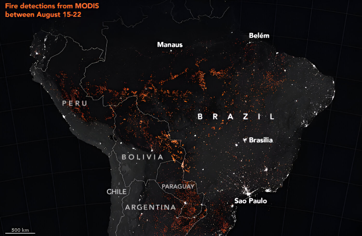
These maps provide perspective. During August and September of 2019, headlines and news items reported that the Amazon rainforest was burning. But when we examine satellite imagery showing both the fires that year and those that burned in the previous four years, we see that the majority of the fires represented annual burning associated with agriculture. The underlying problem, of course, is deforestation.
Deforestation proceeds silently and relentlessly, usually following rivers and road access, as seen in the linearity of the fires (see https://www.washingtonpost.com/opinions/2019/09/05/were-thinking-about-amazon-fires-all-wrong-these-maps-show-why/?noredirect=on). By the time the vegetation burns, the original forest has been felled and often is long gone.
Annual fires in tropical America are not restricted to the Brazilian Amazon. Bolivia also sees large areas in flames every year with significant encroachment on protected areas. Based on satellite images from Bolivia’s early warning fire detection agency, environmental groups estimate the destruction surpassed two million hectares in 2019. About 16% of the damage is within protected areas and fires recently spread into Kaa-Iya, Bolivia’s largest national park in the Gran Chaco
(see https://www.theguardian.com/world/2019/sep/02/bolivia-evo-morales-wildfires-chiquitano).