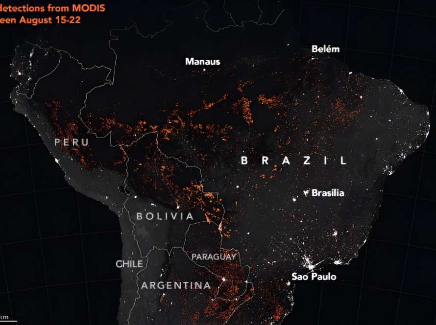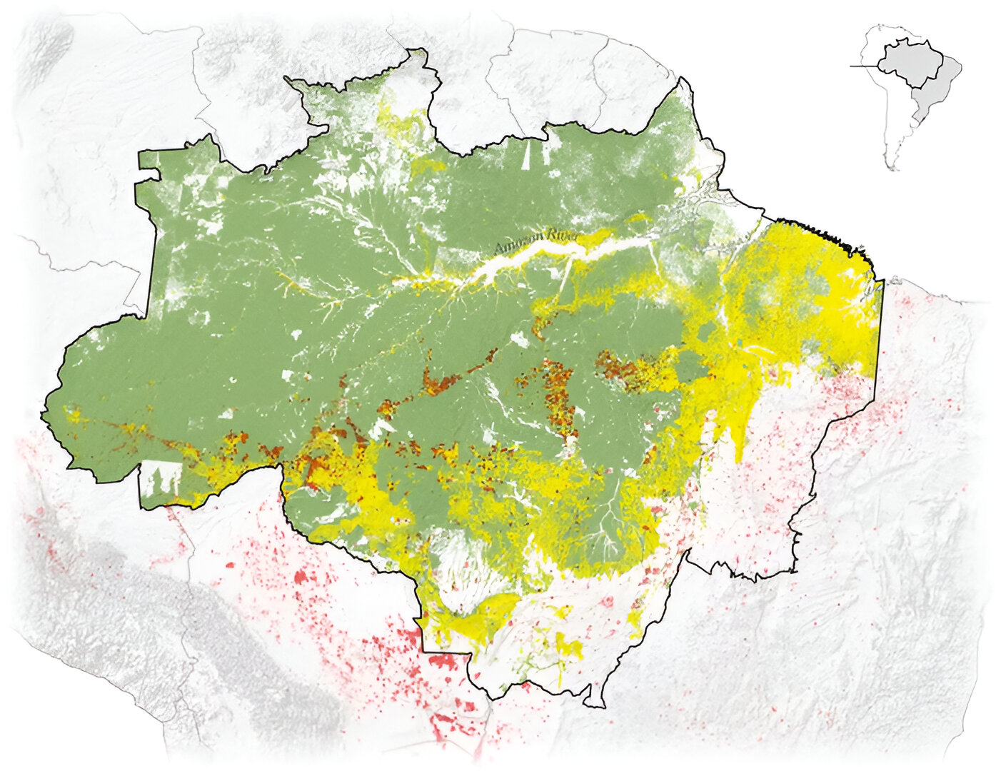
Scientists studying satellite image data from the fires in the Amazon rain forest said that most of the fires are burning on agricultural land where the forest had already been cleared.
Read the full article here:
https://www.nytimes.com/interactive/2019/08/24/world/americas/amazon-rain-forest-fire-maps.html
by K.K. Rebecca Lai, Denise Lu, and Blacki MigliozziRead more: What satellite imagery tells us about the Amazon rainforest fires